Coming soon · iPhone and Android · Ohio first

Find the fields worth walking.

First Rise ranks every crop field in Ohio, then shows you the ground underneath: old creek channels, the first rise above the creek, soils, and the flint to look for.

Join the waitlist

We will only use your email to tell you when the app is ready.

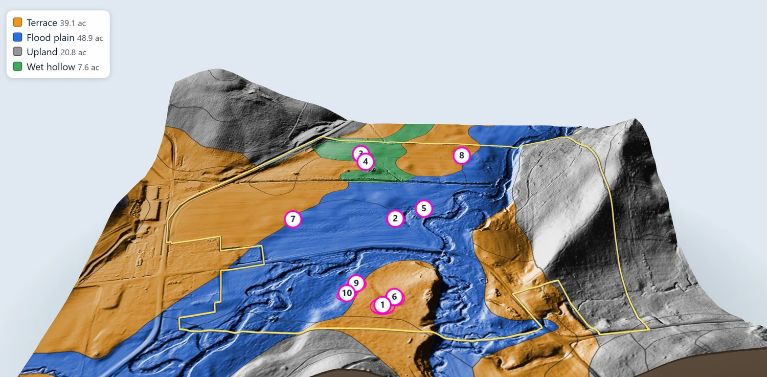
The app's 3D view of a crop field, colored by soil: orange terrace, blue flood plain, gray upland and green wet hollow, with numbered hot spots.

See it in action

A quick tour of the app, a little over two minutes. Tap to play, with sound.

Recorded from an early private version of the app. Owner and sender names are made up, and the storm warning is an example.

What it does

Screens below are from an early private version of the app and will change before launch.

LiDAR ground maps

See the shape of the ground

LiDAR is a laser scan made from aircraft. With the crops and trees stripped away, the shape of the ground shows. First Rise turns it into maps you can read at a glance, and across all of Ohio the detail is down to half a metre (about 20 inches).

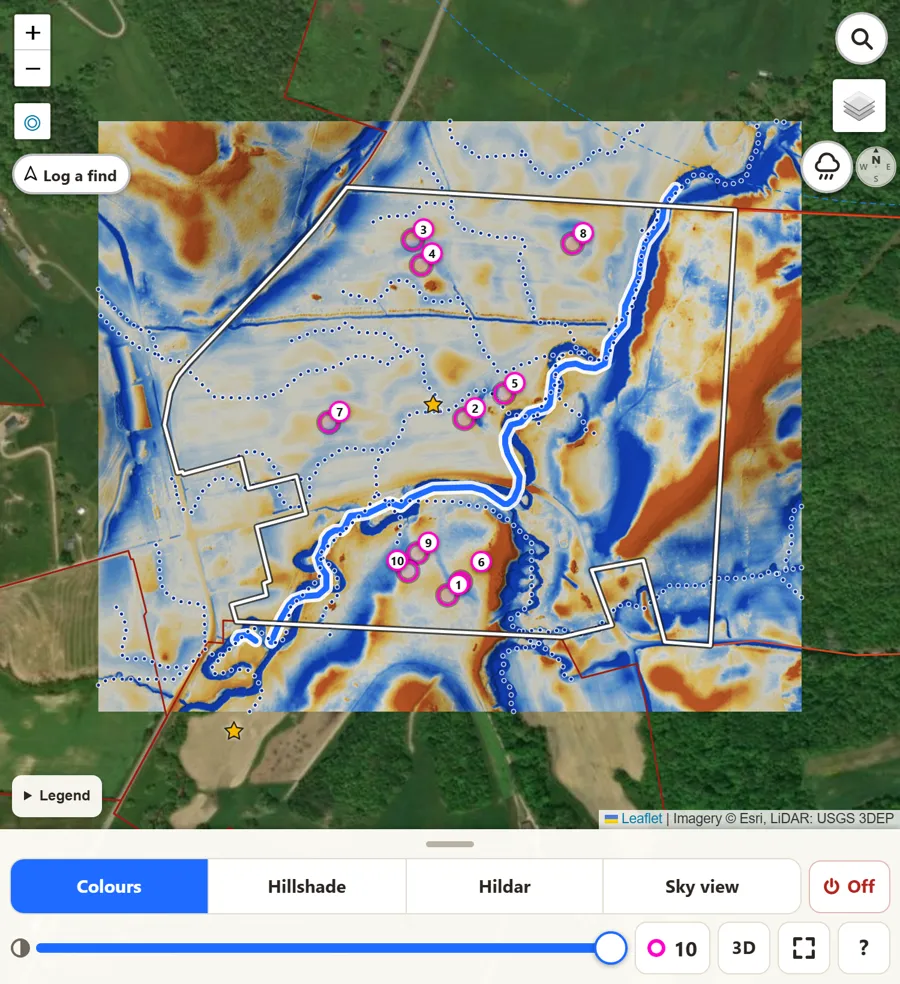
  • Colours
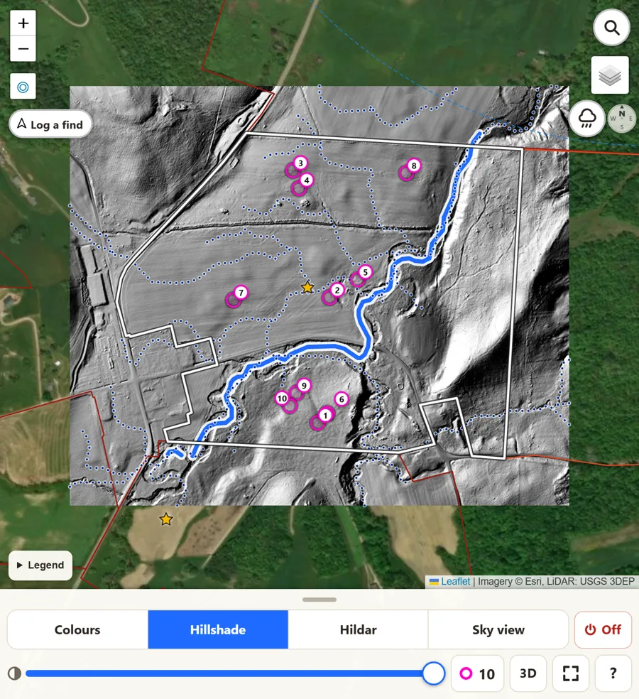
  • Hillshade
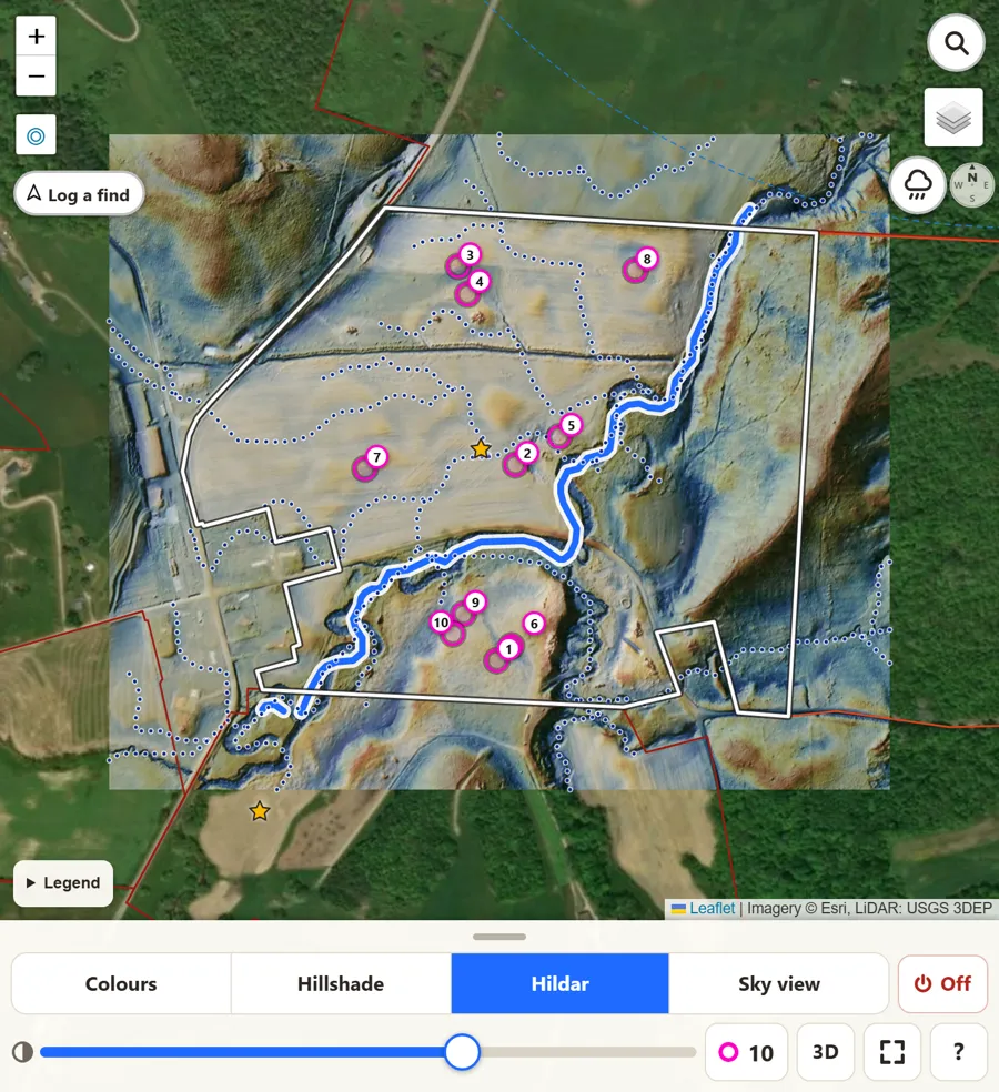
  • Hildar
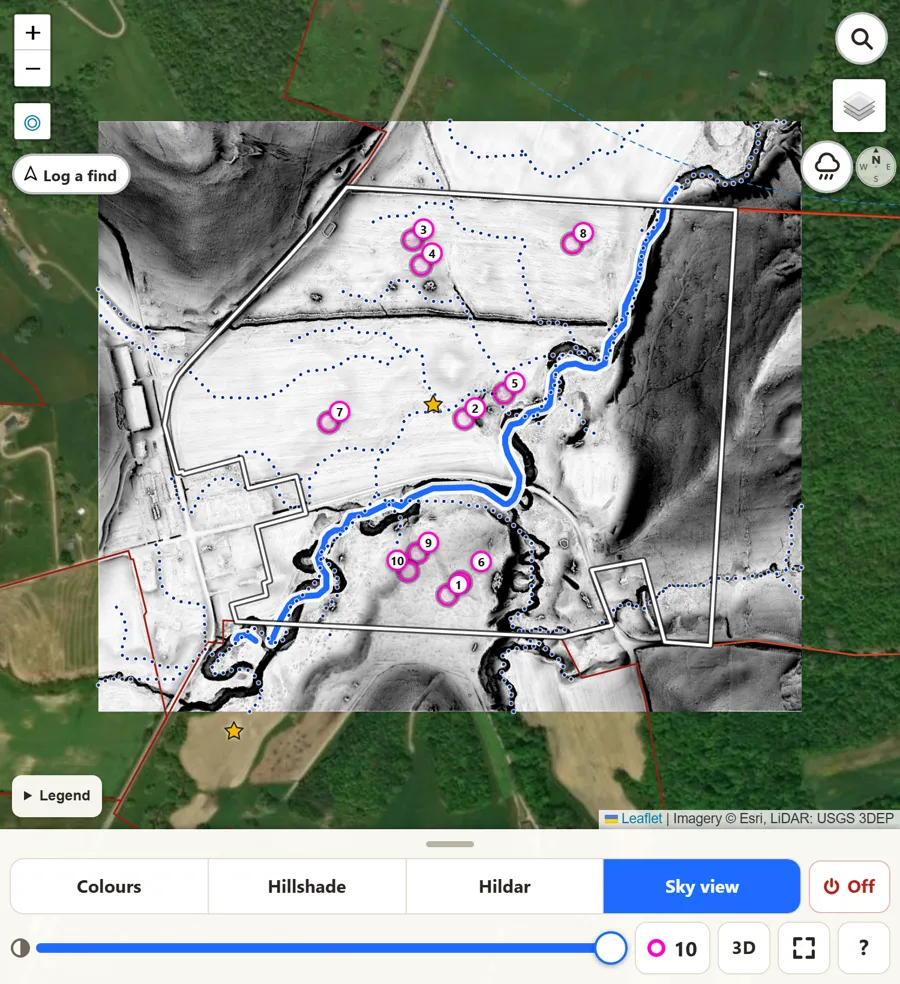
  • Sky view
LiDAR Colours map of a field: blue marks lower ground such as old creek channels, gold and orange mark higher ground, with magenta hot spots.
Colours: gold is a little higher, blue a little lower.
LiDAR Hillshade map of the same field in grey: the ground lit from one side, so banks, terraces and old channels cast soft shadows.
Hillshade: the ground lit from one side, so every bank and old channel casts a shadow.
LiDAR Hildar map of the same field: the height colours blended with the hillshade.
Hildar: the colours and the hillshade together - height and shape at once.
LiDAR Sky view map of the same field in black and white: dark spots mark hollows, old channels and ditches.
Sky view: dark spots see less sky. Hollows, old channels and ditches stand out.

Swipe to see all four views of the same field.
Old creeks and the first rise

Follow the old creek to the first rise

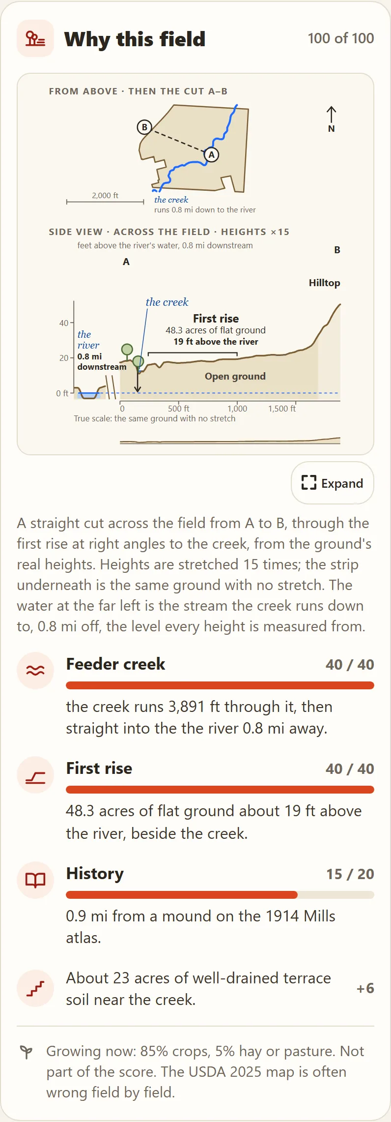
Creeks wander, and the old channels they leave behind show up in LiDAR long after the plow has smoothed them over. A favorite place to start is the first rise, the flat shelf of ground just above the creek.

First Rise draws the old channels and marks hot spots where a gentle rise sits next to one. For each field it shows how high the first rise sits above the river and how many acres of flat ground it holds.

The app's Why this field card: a map of the field from above with the creek, then a side view across it showing the first rise, 48.3 acres of flat ground 19 feet above the river.
Why this field: the creek from above, then a side view across the field - here the first rise holds 48.3 acres of flat ground 19 feet above the river.

Hot spots

Hot spots: where to start walking

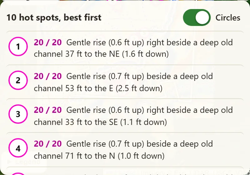
In every field, First Rise looks for the places people most often camped: a gentle rise sitting right beside a deep old creek channel. Each one gets a magenta circle on the map and a score out of 20, numbered best first.

Tap a hot spot to see why it scored, then tap Walk here: the app draws a line from your GPS dot to the spot and tells you how far it is.

The app's hot spot list for one field: numbered circles, each scored 20 out of 20, such as a gentle rise 0.6 feet up right beside a deep old channel 37 feet to the northeast.
Hot spots for one field, best first.

Hunting forecast

Is today a good day to go?

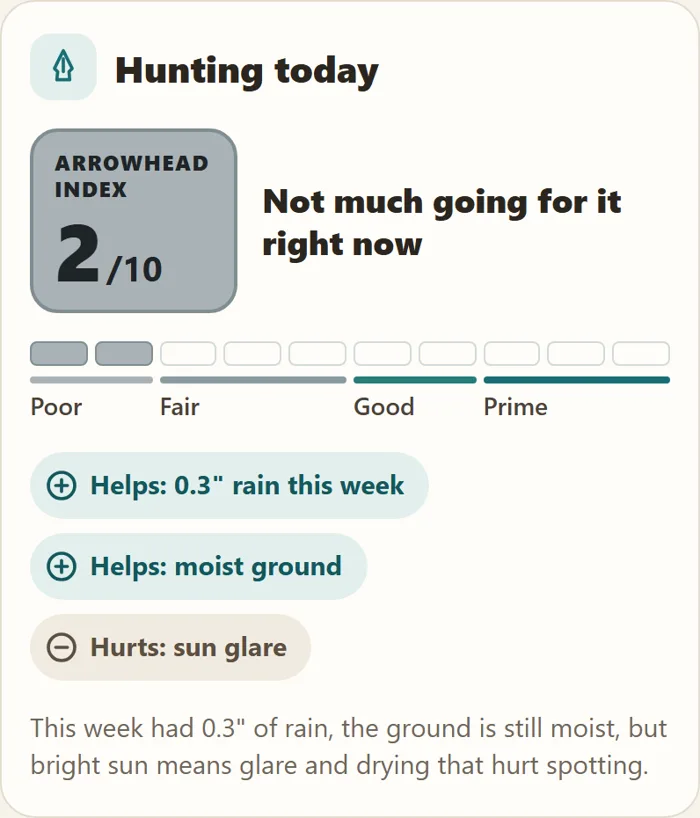
Each field gets an Arrowhead Index from 1 to 10 for spotting conditions right now: recent rain that washes points clean, moist ground, cloud cover (bright sun means glare), cold and thaw, and snow on the ground. It tells you what helps and what hurts in plain words, so you can pick the day as well as the field.

The app's Hunting today card: an Arrowhead Index of 2 out of 10, with rain this week and moist ground helping and sun glare hurting.

Storm and lightning warnings

Know when a storm is coming

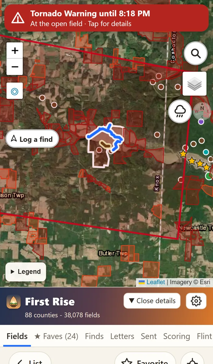
When the National Weather Service puts out a warning for the field you have open, or for where you are standing, it shows across the top of the map: red for a tornado, orange for a severe thunderstorm, yellow for a watch. The warning's outline is drawn on the map, and a tap shows what the weather service says.

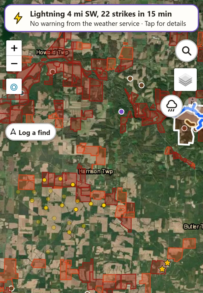
Lightning shows too, often before any warning: how far away the nearest strike is, which way, and the strikes themselves as small marks on the map.

The app on a phone with a red Tornado Warning banner across the top of the map and the warning's red outline drawn around the field.
Tornado warning at the open field, its outline on the map. (An example, made up for this picture.)
The app's lightning banner: Lightning 4 miles southwest, 22 strikes in 15 minutes, no warning from the weather service, with the strikes as small yellow marks on the map.
Lightning 4 miles off, before any warning. (An example, made up for this picture.)

Swipe to see both.

Rain radar

Watch the rain come in

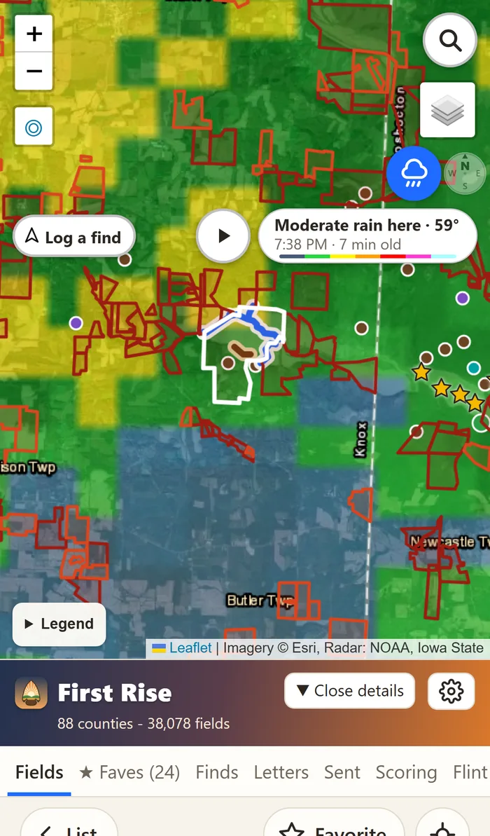
Live weather radar right on the map, over the fields. It says what is falling at the field right now and how old the radar picture is, and one tap plays the last hour so you can see which way the rain is moving.

Live rain radar over a field in the app: green, yellow and blue rain over the map, with the label Moderate rain here, 59 degrees, and a play button for the last hour.

Weather and daylight

Make the most of first light

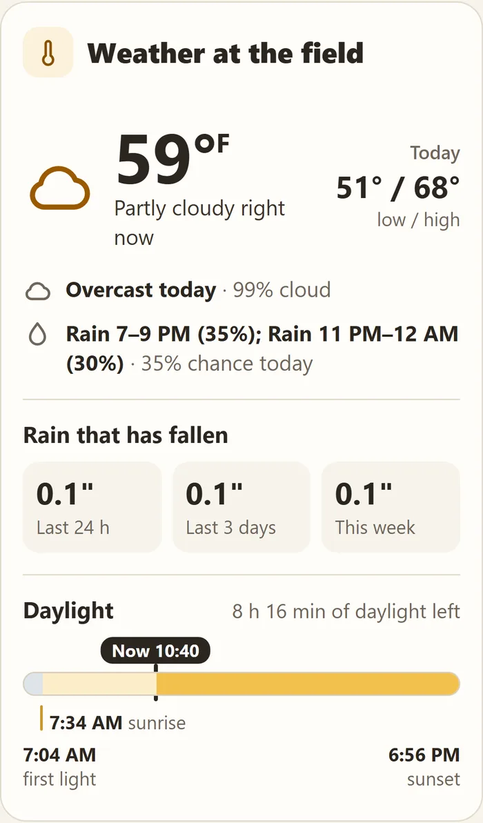
Every field has its own weather: the temperature now, when rain is due, and how much rain has already fallen in the last day, three days and week.

A daylight timeline shows first light, sunrise and sunset, and how much daylight you have left, so you know how long you have to walk before dark.

The app's Weather at the field card: 59 degrees, rain due this evening, rain that has fallen, and a daylight timeline from first light at 7:04 AM and sunrise at 7:34 AM to sunset at 6:56 PM, with 8 hours 16 minutes of daylight left.

3D view

Walk the field in 3D before you go

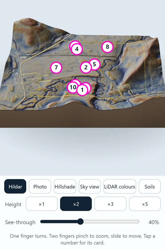
Turn a 3D model of any field with one finger and pinch to zoom. Stretch the height so banks and terraces stand out, slide the see-through control, and tap a numbered hot spot to see its card.

The 3D view in the Hildar layer, with layer buttons, height settings and a see-through slider under the model.

Soil map

Read the soil at a glance

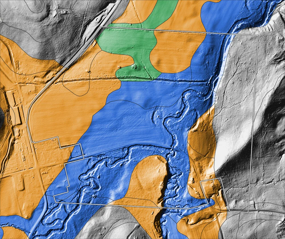
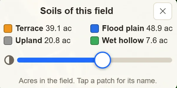
The USDA soil map is laid over the LiDAR in plain colors: terrace, flood plain, upland and wet hollow. See how many acres of each are in the field, and tap a patch for its soil name.

Soil colors draped over a LiDAR hillshade: orange terrace, blue flood plain with winding old channels, gray upland and green wet hollow.
The app's Soils of this field key: terrace, flood plain, upland and wet hollow, with acres for each.

Flint guide

Know your flint

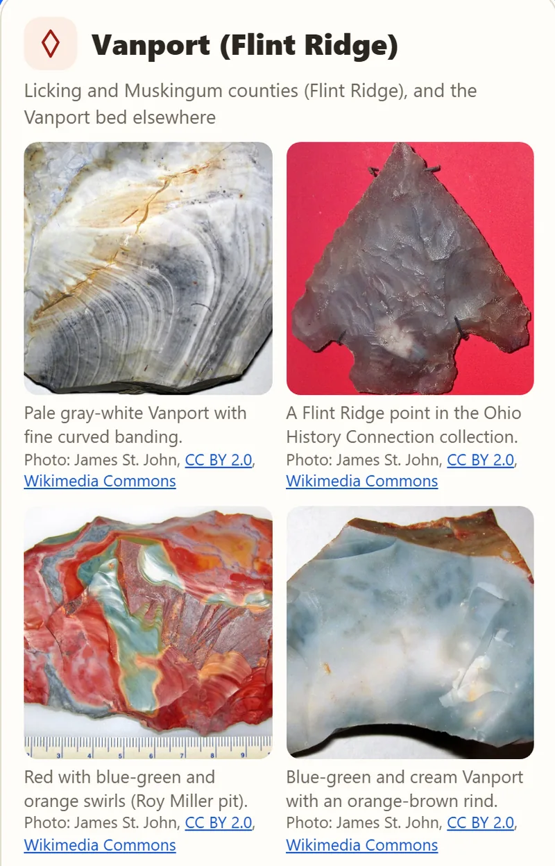
A built-in guide to Ohio flint, with photos and plain descriptions: Vanport (Flint Ridge), Upper Mercer (Coshocton Black), Delaware, Nellie, Brush Creek, Zaleski, Plum Run and Pipe Creek, plus the types that were traded in from other states.

Each field lists the flints you are likely to find there and how far away each source is.

A flint guide card for Vanport (Flint Ridge) with four photos: pale banded flint, a Flint Ridge point, red and blue-green swirled flint, and blue-green flint.

Maps

Old maps, topo lines and offline maps

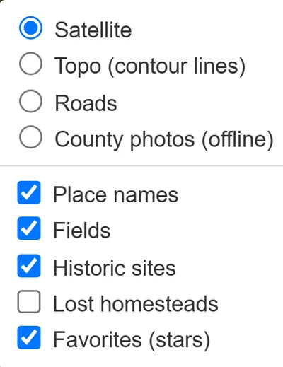
Switch on historic sites from the 1914 Mills atlas, lost homesteads (house sites on the old USGS maps that are gone today), topo contour lines, roads and place names from one menu.

Download a county at home on Wi-Fi, and its fields, LiDAR maps, hot spots and aerial photos keep working in fields with no signal.

The map layers menu: satellite, topo contour lines, roads, county photos offline, place names, fields, historic sites, lost homesteads and favorites.

Coming soon

Know when a field has been plowed

Fresh satellite pictures of Ohio come in every few days when the sky is clear. We're teaching First Rise to spot when a field turns from crop or stubble to freshly worked bare dirt, so you'll know which fields are ready to walk before you drive out.

Also in the app

  • Every field scored

    Nearly a quarter of a million crop fields across all 88 Ohio counties, each scored out of 100. Sort the best first.

  • Field numbers

    Every field has a short number, such as OH-KNO-4821, to search for or share with a friend.

  • Log your finds

    Save each find with a GPS pin so you can get back to the spot.

  • Favorite fields

    Star the fields you want to come back to.

  • Permission letters

    Printable landowner permission letters to take with you.

  • Offline maps

    Maps that work in the field when your phone has no signal.

Hunt responsibly

Good hunting starts with permission.

  1. Always ask the landowner first.Never walk a field without permission. First Rise can print a permission letter for you.
  2. Public land: look, don't collect.Collecting on federal land, including Army Corps of Engineers land, and on many state lands is illegal. The app marks public land “look, don't collect.”
  3. Never dig in mounds or burials.Leave them alone, and leave them as you found them.

Rules differ from place to place and change over time. Check them before you go.

First Rise app icon: an arrowhead showing a sunrise over fields.

First Rise: Artifact FinderComing to iPhone and Android. Ohio first.

Join the waitlist

Leave your email and we will tell you when First Rise is ready. Adding your county is optional.

Your email is used only to announce the app. It is never sold. Privacy